** Progress in Earth and Planetary Science is the official journal of the Japan Geoscience Union, published in collaboration with its society members.


Gallery View of PEPS Articles
Research
Atmospheric and hydrospheric sciences
202105202105
Flood Inundation Simulations based on GSMaP Satellite Rainfall Data in Jakarta, Indonesia
Priyambodoho AB, Kure S, Yagi R, Januriyadi FN
GSMaP, Flood inundation simulation, Rainfall runoff simulation, Jakarta, Indonesia, Chiliwung River
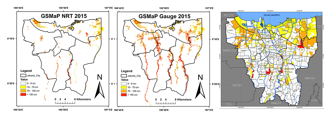
Flood Inundation comparisons for flood event of 2015. (left: NRT, middle: Gauge and right: survey report)
Jakarta is the capital of Indonesia and is considered one of the most vulnerable cities to climate-related disasters, including flooding, sea-level rise, and storm surges. Therefore, the development of a flood-forecasting system for Jakarta is crucial. However, the accurate prediction of flooding in Jakarta is challenging because of the short flood concentration time in highly urbanized basins and the shortage of rainfall data in poorly gauged areas. The aim of this study is to simulate recent flood inundation using global satellite mapping of precipitation (GSMaP) products. The GSMaP products (NRT and Gauge V7) were evaluated and compared with hourly observation data from five ground stations in the Ciliwung River Basin. In addition, a rainfall-runoff and flood inundation model was applied to the target basin. The results of the analysis showed that the GSMaP Gauge data were more accurate than the GSMaP NRT data. However, the GSMaP Gauge cannot be used to provide real-time rainfall data and is, therefore, inadequate for real-time flood forecasting. We conclude that the GSMaP Gauge is suitable for replicating past flood events, but it is challenging to use the GSMaP NRT for real-time flood forecasting in Jakarta.
