** Progress in Earth and Planetary Science is the official journal of the Japan Geoscience Union, published in collaboration with its 51 society members.
** Progress in Earth and Planetary Science is partly financially supported by a Grant-in-Aid for Publication of Scientific Research Results to enhance dissemination of information of scientific research.


Gallery View of PEPS Articles
Research
Solid earth sciences
Surface deformation and source modeling of Ayaz-Akhtarma mud volcano, Azerbaijan, as detected by ALOS/ALOS-2 InSAR
Iio K, Furuya M
Mud volcano, Surface deformation, Geodesy, Interferometric synthetic aperture radar, Multiple-aperture interferometry, Advanced Land Observing Satellite, Elastic dislocation model
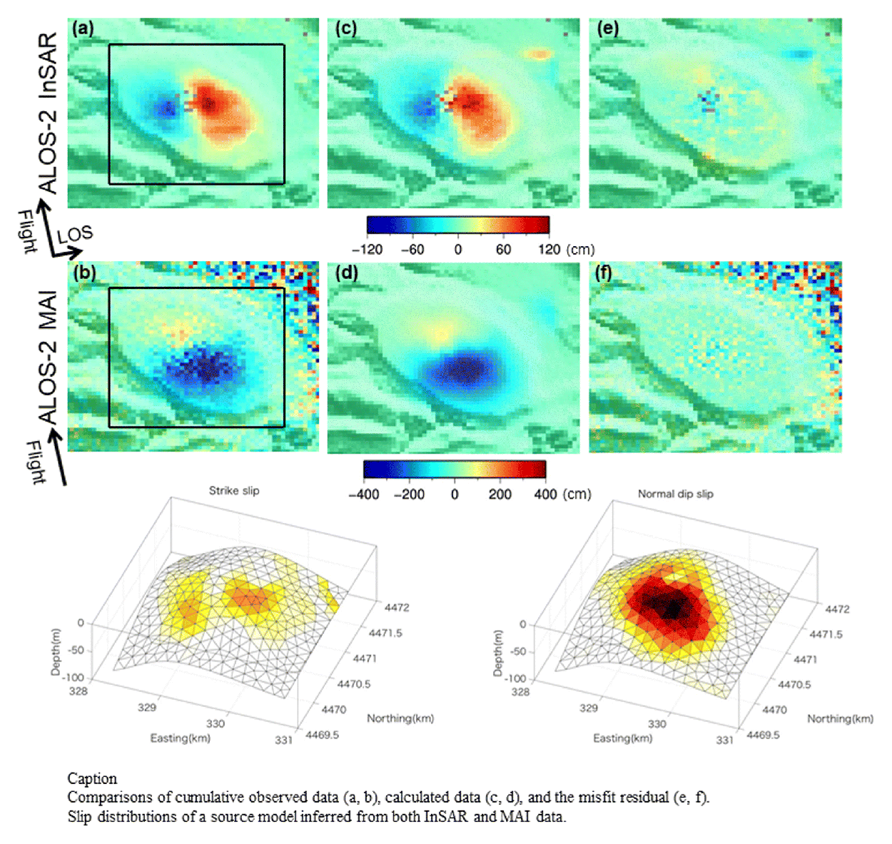
Azerbaijan, located on the western edge of the Caspian Sea in Central Asia, has one of the highest populations of mud volcanoes in the world. We used satellite-based synthetic aperture radar (SAR) images derived from two L-band SAR satellites, ALOS/PALSAR along an ascending track from 2006 to 2011, and its successor ALOS-2/PALSAR-2 along both ascending and descending tracks from 2014 to 2017. First, we applied interferometric SAR (InSAR) technique to detect surface displacements at the Ayaz-Akhtarma mud volcano in Azerbaijan. The 35 derived interferograms indicate that the deformation of the mud volcano is largely characterized by horizontal displacement. Besides the InSAR technique, we also used multiple-aperture interferometry (MAI) to derive the surface displacements parallel to the satellite flight direction to complement the InSAR data. Using the InSAR and MAI data, we obtained 3D displacements, which indicate that the horizontal displacement is dominant relative to subsidence and possible uplift. To explain the displacements, we performed source modeling, based on the assumption of elastic dislocation theory in a half space. The derived model consists of a convex surface on which normal-fault-type slips are semi-radially distributed, causing the significant horizontal displacements with minor subsidence. The convex source surface suggests that a steady overpressure system would be maintained by constantly intruding mud and gas.
