** Progress in Earth and Planetary Science is the official journal of the Japan Geoscience Union, published in collaboration with its 50 society members.


Gallery View of PEPS Articles
Research
Human geosciences
202103202103
Formation of undulating topography and gravel beds at the bases of incised valleys: Last Glacial Maximum examples beneath the lowlands facing Tokyo Bay
Susumu Tanabe, Yoshiro Ishihara
Basal gravel bed (BG), Braided river, Scour, Cover effect, Sea-level change, AT tephra
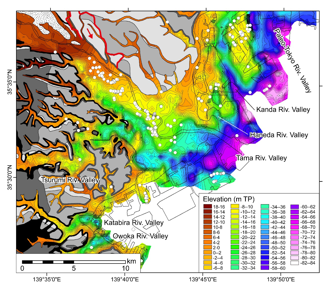
Depth distribution of the base of the BG beneath the Tama River Lowland. White circles indicate distribution of loam beds
Recent studies using well density distributed borehole logs have revealed undulating topography at the bases of incised valleys formed during the Last Glacial Maximum (LGM). In this study, from analysis of 4702 borehole logs, undulating topography forming a series of pits 1–2 km long, < 1 km wide, 5–10 m deep, and spaced at 1–2-km intervals was discovered at the bases of LGM incised valleys beneath the Tama River Lowland on the west coast of Tokyo Bay. This undulating topography can be attributed to scouring at braided river channel confluences. In the study area, single borehole logs are available within each 187 m × 187 m grid cell, and the logs sample both the bottom and marginal portions of the scouring, which suggests that this undulating topography is not an artifact of erroneous values arising from mathematical interpolation. The morphologies and incision depths of two incised valleys in the study area show a cover effect of the gravel bed at the base of the post-LGM incised-valley fills. The basal age of this basal gravel bed (BG) is confirmed at < 30 ka because the LGM incised valleys dissect the MIS 3 Tachikawa buried terrace overlain by the AT tephra dated 30.0 ka. This means that the BG, which represents braided-river sediments, is interpreted as resulting from the LGM sea-level lowstand after 30 ka.
