** Progress in Earth and Planetary Science is the official journal of the Japan Geoscience Union, published in collaboration with its 50 society members.
Gallery View of PEPS Articles
Research
Human geosciences
202006202006
Spatial Accuracy Assessment of Unmanned Aerial Vehicle-Based Structures from Motion Multi-View Stereo Photogrammetry for Geomorphic Observations in Initiation Zones of Debris Flows, Ohya Landslide, Japan
Tsunetaka H, Hotta N, Hayakawa SY, Imaizumi F
UAV-SfM, TLS, ICP, Debris flow
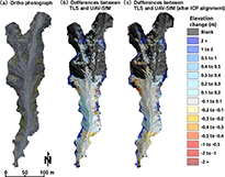
Comparisons of UAV-SfM measurements: (a) orthophotograph, (b) between TLS and UAV-SfM, and (c) between TLS and UAV-SfM after ICP alignment.
Fluctuations in sediment storage arising from sediment discharge and recharge in headwater channels are an important factor influencing changes in landforms in mountainous areas, but the frequency of surveys is limited because of access difficulties and complex topography. Although unmanned aerial vehicle-based structure-from-motion photogrammetry (UAV-SfM) may be effective for topographic measurement, its utilization in headwater channels has not been fully examined. We assessed the accuracy and reproducibility of a digital elevation model acquired via UAV-SfM (DEMSfM) in a headwater channel within the Ohya landslide area, Japan, using a DEM acquired via terrestrial laser scanning (DEMTLS). The results indicate that differences in the measured elevation between DEMSfM and DEMTLS in the vicinity of the channel bed ranged from about 0.4 to −0.4 m, with a median of 0.06 m. Hence, the profiles acquired via DEMSfM coincide well with those acquired via DEMTLS, and the spatial distributions and histograms of the measured surface slope were nearly the same for UAV-SfM and TLS. However, part of the DEMSfM indicates low elevation compared with DEMTLS, probably because of topical distortion arising from technical problems in UAV-SfM. The positive and negative differences in volume between DEMSfM and DEMTLS were approximately 200 and −30 m3, respectively. To remedy this bias, an alignment of the UAV-SfM point cloud using the TLS point cloud in the hillslope sections was conducted, based on an iterative closest point (ICP) algorithm. Consequently, the median of the elevation differences decreased to −0.002 m, resulting in the positive and negative differences becoming approximately 100 m3. This demonstrates that ICP-based alignment can lead to a reduction of the deviation of differences in the estimated volume. In terms of eliminating biases due to topical distortion in elevation, this approach would be valid for the estimation of volumetric changes using UAV-SfM.


