** Progress in Earth and Planetary Science is the official journal of the Japan Geoscience Union, published in collaboration with its 50 society members.


Gallery View of PEPS Articles
Research
Atmospheric and hydrospheric sciences
202001202001
Benefits of high-resolution downscaling experiments for assessing strong wind hazard at local scales in complex terrain: a case study of Typhoon Songda (2004)
Tetsuya Takemi, Rui Ito
Dynamical downscaling, Strong wind, Typhoon hazard, Impact assessment, Mesoscale meteorological model
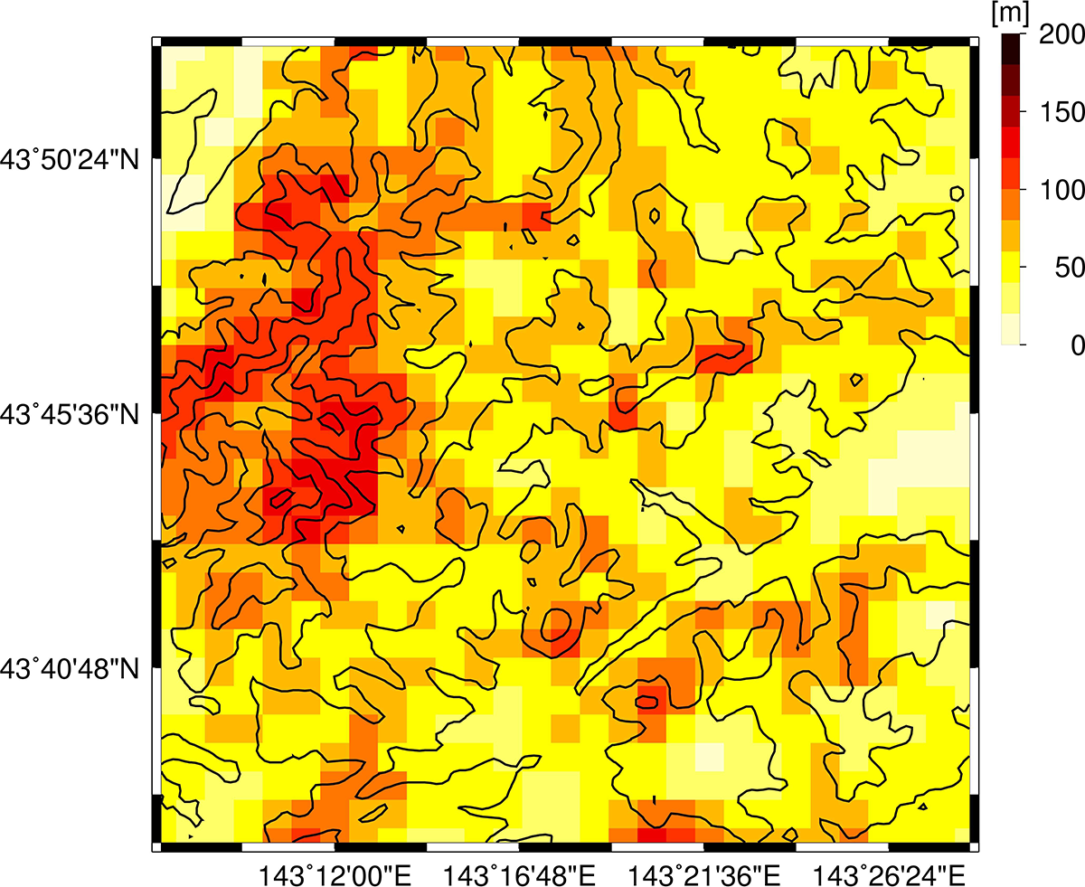
The spatial distribution of a parameter representing the subgrid-scale orography

The relationships between the subgrid-scale orography and the area-maximum wind speed (Black: the 200-m grid case; gray: the 1-km grid case)
This study investigated the representation of surface winds in complex terrain during the passage of Typhoon Sondga (2004) in downscaling simulations with the horizontal grid spacing of 200 m. The mountainous areas in Hokkaido where forest damages occurred in the typhoon event were chosen for the present analysis. The 200 m grid simulations were compared with the simulations with the grid spacing of 1 km. The 200 m grid simulations clearly indicated more enhanced and more frequent extremes both in the stronger and weaker ranges of surface winds than the 1 km grid case. Both in the 200 m grid and 1 km grid cases, the mean and maximum winds in the analysis areas during the simulated time period increase with the increase in the terrain slope angle, but in the 200 m grid case, the relationships of the mean and maximum winds against the terrain slope angle includes wide scatter. In this way, the response of the wind representations to the grid spacing appears differently between the 200 m and 1 km grid cases. A parameter characterized subgrid-scale orography was used to quantify the influences of the terrain complexity on surface winds, demonstrating that the area-maxima and spatial variance of surface winds are more enhanced with the increase in the subgrid-scale orography in the higher-resolution case. It is suggested that the high-resolution simulations at the 200 m grid highlight the fluctuating nature of surface winds in complex terrain, because of the better representation of the model terrain at 200 m. Benefits of the representation of surface winds in simulations at the resolution on the order of 100 m are due to the better representation of complex terrain, which enables to quantitatively assess the impacts of strong winds on forest and natural vegetation in complex terrain.
