** Progress in Earth and Planetary Science is the official journal of the Japan Geoscience Union, published in collaboration with its 50 society members.


Gallery View of PEPS Articles
Research
Human geosciences
Scaling land-surface variables for landslide detection
Sîrbu F, Drăguţ L, Oguchi T, Hayakawa Y, Micu M
Landslide scarp, Random forest, Landslide modeling, Landslide inventory, Romania, Japan
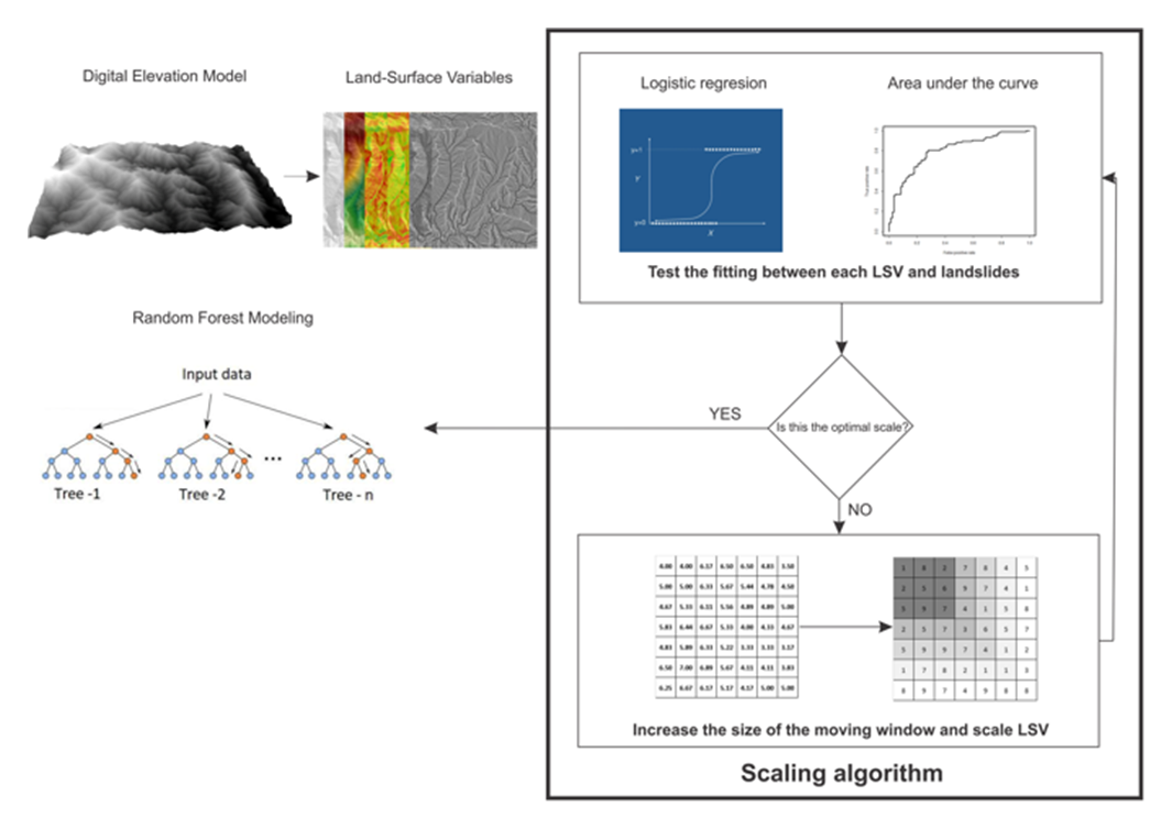
Experimental work flow
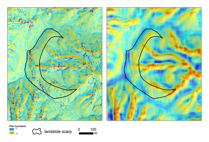
Example of a scaled predictor in relation to a landslide scarp in the Shizuoka area. Left image: plan curvature at the default scale. Right image: plan curvature scaled in a 9 × 9 window. Note a north-south trench inside the landslide scarp on the left image is filtered out on the right image
As geomorphological processes operate at various spatial scales, their morphological expressions, i.e., land-surface variables (LSVs) should be scaled accordingly. Most approaches on landslide susceptibility modeling and landslide detection have been performed based on arbitrarily scaled LSVs. We propose a methodology to improve automated landslide detection by fitting each LSV to its optimal scale. We test our approach on two landslide inventories, with different landslide morphology. First, we derive seven LSVs from a DEM in a standard 3 × 3 moving window. Then, we rescale each LSV using focal mean statistics in increasingly larger moving windows until the optimal scale is found, i.e., scale at which logistic regression shows the best fit between the existence of landslide scarps and individual LSVs. The LSVs at the optimal scale are used as input data in a random forest (RF) model. In order to calculate the effect of scaling predictors on the accuracy of the model, we compare the results, using the area under the curve (AUC), against the results from an RF model with unscaled LSVs as input data. The results show (i) that different LSVs have different optimal scales, and (ii) the multi-scale approach improved the models significantly, from AUC = 0.73 to 0.80 for the first study area and from AUC = 0.59 to 0.73 for the second study area. Based on these results, we conclude that a multi-scale approach should be considered when automated models are used in order to detect landslides, in complex terrain settings.
