** Progress in Earth and Planetary Science is the official journal of the Japan Geoscience Union, published in collaboration with its 51 society members.
** Progress in Earth and Planetary Science is partly financially supported by a Grant-in-Aid for Publication of Scientific Research Results to enhance dissemination of information of scientific research.


Gallery View of PEPS Articles
Research
Human geosciences
201712201712
Paleo-tsunami history along the northern Japan Trench: evidence from Noda Village, northern Sanriku coast, Japan
Inoue T, Goto K, Nishimura Y, Watanabe M, Iijima Y, Sugawara D
Paleo-tsunami, Sanriku coast, Japan, Tsunami deposit identification, AD 869 Jogan tsunami, Storm wave, Numerical modeling
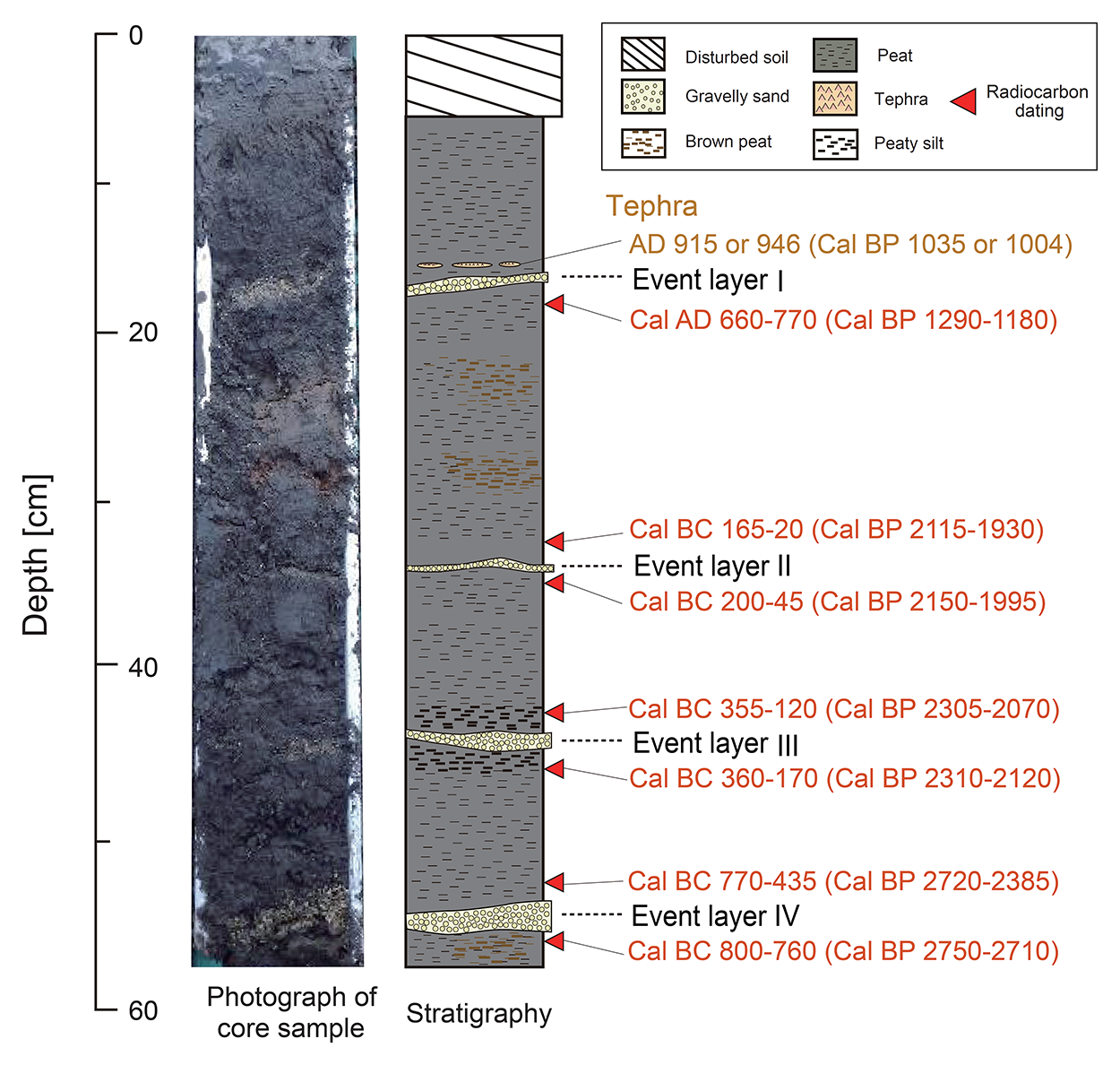
Photograph, stratigraphy, and the radiocarbon dating results of core NM-K. From top to bottom, the deposits in cores NM-K are labeled as event layers I, II, III, and IV. Red arrowheads indicate the locations of samples for radiocarbon dating.
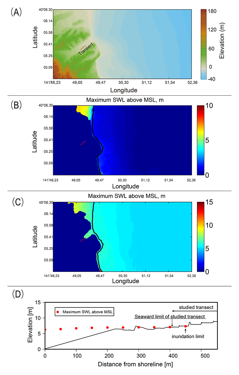
(A) Domain of the numerical experiment. The red line denotes the transect. Numerical results are shown for maximum seawater level of (B) Case 1C (20 m wave height, 20 s period, and water level 0 m) and (C) Case 2C (20 m wave height, 20 s period, and water level 5 m). Black line denotes the shoreline. (D) Cross-sectional profile of the maximum seawater level (red points) above the mean sea level in Case 2C. A minor discrepancy between the red points and altitude data occurs because of the difference between our own measured altitude data along the transect and the topographic data used for the numerical simulation.
Throughout history, large tsunamis have frequently affected the Sanriku area of the Pacific coast of the Tohoku region, Japan, which faces the Japan Trench. Although a few studies have examined paleo-tsunami deposits along the Sanriku coast, additional studies of paleo-earthquakes and tsunamis are needed to improve our knowledge of the timing, recurrence interval, and size of historical and pre-historic tsunamis. At Noda Village, in Iwate Prefecture on the northern Sanriku coast, we found at least four distinct gravelly sand layers based on correlation and chronological data. Sedimentary features such as grain size and thickness suggest that extreme waves from the sea formed these layers. Numerical modeling of storm waves further confirmed that even extremely large storm waves cannot account for the distribution of the gravelly sand layers, suggesting that these deposits are highly likely to have formed by tsunami waves. The numerical method of storm waves can be useful to identify sand layers as tsunami deposits if the deposits are observed far inland or at high elevations. The depositional age of the youngest tsunami deposit is consistent with the AD 869 Jogan earthquake tsunami, a possible predecessor of the AD 2011 Tohoku-oki tsunami. If this is the case, then the study site currently defines the possible northern extent of the AD 869 Jogan tsunami deposit, which is an important step in improving the tsunami source model of the AD 869 Jogan tsunami. Our results suggest that four large tsunamis struck the Noda site between 1100 and 2700 cal BP. The local tsunami sizes are comparable to the AD 2011 and AD 1896 Meiji Sanriku tsunamis, considering the landward extent of each tsunami deposit.
