** Progress in Earth and Planetary Science is the official journal of the Japan Geoscience Union, published in collaboration with its 51 society members.
** Progress in Earth and Planetary Science is partly financially supported by a Grant-in-Aid for Publication of Scientific Research Results to enhance dissemination of information of scientific research.


Gallery View of PEPS Articles
Research
Space and planetary sciences
Session convener-recommended article JpGU Meeting 2016
201709201709
Distribution, morphology, and morphometry of circular mounds in the elongated basin of northern Terra Sirenum, Mars
Hemmi R and Miyamoto H
Mars, Terra Sirenum, Remote sensing, Mud volcanism
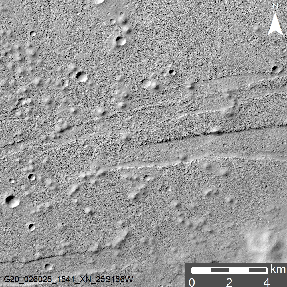
Circular mounds and fractures in the basin of Terra Sirenum, Mars
An elongated, flat-floored basin, located in the northern part of Terra Sirenum on Mars, holds numerous enigmatic mounds (100 m wide) on the surface of its floor. We investigated their geological context, spatial distribution, morphological characteristics, and morphometric parameters by analyzing a variety of current remote sensing data sets of Mars. Over 700 mounds are identified; mapping of the mounds shows the spatial density of about 21 per 100 km2 and appearances of several clusters, coalescence, and/or alignment. Most of the mounds have smoother surface textures in contrast to the rugged surrounding terrain. Some of the mounds display depressions on their summits, meter-sized boulders on their flanks, and distinct lobate features. We also perform high-resolution topographic analysis on 50 isolated mounds, which reveals that their heights range from 6 to 43 m with a mean of 18 m and average flank slopes of most mounds are below 10°. These characteristics are consistent with the deposition and extension of mud slurries with mud breccia and gases extruded from subsurface, almost equivalent to terrestrial mud volcanism. If so, both abundance of groundwater and abrupt increase in pore fluid pressure are necessary for triggering mud eruption. Absolute crater retention ages suggest that the floor of the basin located among middle Noachian-aged highland terrains has been resurfaced during the Late Hesperian Epoch. Because of cross-cutting relationships with the basin and the mounds superposed on the basin floor, the faults and fissures (part of Memnonia Fossae) are thought to have formed during and/or after the period of mound formation. Compressional stress fields which likely formed Memnonia Fossae and Mangala Valles, expected from the dike emplacement model of Wilson and Head (JGR 107:1-1–1-24, 2002), may have facilitated undercompaction or overpressurization of subsurface fluids, focused pore fluids beneath the basin, and opened conduits along faults for upwelling voluminous sediments and fluids.
