** Progress in Earth and Planetary Science is the official journal of the Japan Geoscience Union, published in collaboration with its 51 society members.
** Progress in Earth and Planetary Science is partly financially supported by a Grant-in-Aid for Publication of Scientific Research Results to enhance dissemination of information of scientific research.
Gallery View of PEPS Articles
Research
Atmospheric and hydrospheric sciences
201707201707
Shigaraki UAV-Radar Experiment (ShUREX): overview of the campaign with some preliminary results
Kantha L, Lawrence D, Luce H, Hashiguchi H, Tsuda T, Wilson R, Mixa T, Yabuki M
VHF radar, MU radar, MST radar, Unmanned Aerial vehicles, UAV, Turbulent mixing, Sheets and layers, High humidity gradient sheets, Mid-level cloud-base turbulence, Convective boundary layer, Kelvin Helmholtz Instability, Troposphere, Moist troposphere
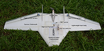
The Shigaraki unmanned aerial vehicle (UAV)-Radar Experiment (ShUREX) is an international (USA-Japan-France) observational campaign, whose overarching goal is to demonstrate the utility of small, lightweight, inexpensive, autonomous UAVs in probing and monitoring the lower troposphere and to promote synergistic use of UAVs and very high frequency (VHF) radars. The 2-week campaign lasting from June 1 to June 14, 2015, was carried out at the Middle and Upper Atmosphere (MU) Observatory in Shigaraki, Japan. During the campaign, the DataHawk UAV, developed at the University of Colorado, Boulder, and equipped with high-frequency response cold wire and pitot tube sensors (as well as an iMET radiosonde), was flown near and over the VHF-band MU radar. Measurements in the atmospheric column in the immediate vicinity of the radar were obtained. Simultaneous and continuous operation of the radar in range imaging mode enabled fine-scale structures in the atmosphere to be visualized by the radar. It also permitted the UAV to be commanded to sample interesting structures, guided in near real time by the radar images. This overview provides a description of the ShUREX campaign and some interesting but preliminary results of the very first simultaneous and intensive probing of turbulent structures by UAVs and the MU radar. The campaign demonstrated the validity and utility of the radar range imaging technique in obtaining very high vertical resolution (~20 m) images of echo power in the atmospheric column, which display evolving fine-scale atmospheric structures in unprecedented detail. The campaign also permitted for the very first time the evaluation of the consistency of turbulent kinetic energy dissipation rates in turbulent structures inferred from the spectral broadening of the backscattered radar signal and direct, in situ measurements by the high-frequency response velocity sensor on the UAV. The data also enabled other turbulence parameters such as the temperature structure function parameter C2T and refractive index structure function parameter C2n to be measured by sensors on the UAV, along with radar-inferred refractive index structure function parameter C2n,radar. The comprehensive dataset collected during the campaign (from the radar, the UAV, the boundary layer lidar, the ceilometer, and radiosondes) is expected to help obtain a better understanding of turbulent atmospheric structures, as well as arrive at a better interpretation of the radar data.


